
Arctic Sea Ice Shrinks to Tenth-Lowest Level on Record.
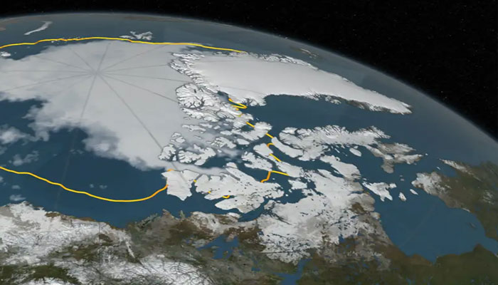
Arctic sea ice has reached its seasonal low, with satellite data showing an extent of 1.78 million square miles on September 10, 2025—the tenth-lowest level since records began nearly 50 years ago.
The annual melt cycle sees Arctic ice retreat each summer before regrowing in winter. While this year’s figure is not a record, NASA scientists say it adds to the long-term trend of decline linked to rising global temperatures. The sharpest low was recorded in 2012, when unusual warmth and weather patterns drove coverage down to 1.31 million square miles.
Researchers emphasize that since 2007, summer ice levels have consistently remained well below earlier averages, leaving the Arctic’s ice thinner and more fragile.
Antarctic Contrast
Antarctic sea ice, meanwhile, is nearing its winter peak but remains below the seasonal norm. Unlike the Arctic, the Southern Hemisphere shows more irregular patterns, as regional winds and weather can obscure long-term signals.
Still, nearly five decades of satellite observations reveal that both poles reflect the broader reality of a warming planet. Scientists say the 2025 minimum is another marker of how Earth’s frozen frontiers are steadily transforming.
Comments are closed.