
Dehradun Faces Heavy Rain, Flooding: Experts Point to Extreme Weather Patterns
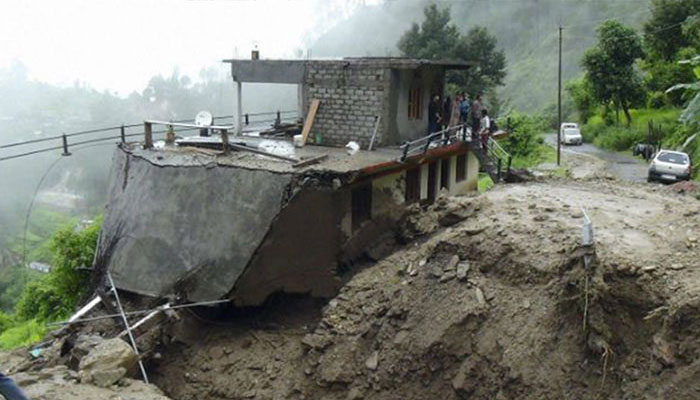
Heavy rainfall lashed Dehradun overnight, submerging homes and temples, washing away a 100-meter stretch of road, and swelling the Tamsa river. The extreme weather caused significant damage and highlighted the increasing impact of intense rain events, including flash floods, cloudbursts, and landslides.
Dr Chander Singh Tomar, Head of the India Meteorological Centre (IMD), Dehradun, clarified that Monday night’s rainfall cannot be classified as a cloudburst. “A cloudburst is 100 mm or more of rain in an hour. Dehradun recorded 67 mm per hour, which is still an extreme rainfall event,” he said.
Mr Tomar explained that the heavy rain resulted from the interaction of easterly and westerly winds over the region. An orange alert was issued and remained in effect until 8:30 am on September 17. The IMD also warned of continued very heavy rainfall in Dehradun, Nainital, and Champawat, and heavy rainfall in Chamoli, Udham Singh Nagar, Bageshwar, and Pithoragarh.
Since June 1, Uttarakhand has received 1,343.2 mm of rain—22% above normal—with Bageshwar district recording 239% surplus rainfall. IMD experts say such variations, whether excess or deficit, are part of normal monsoon patterns.
However, Yaspal Sundriyal, former head of geology at HNB Garhwal University, linked extreme rainfall events to climate change. He said intersecting air masses, forming “triple junctions,” can trigger intense rain, thunderstorms, and strong winds. Sundriyal added that while overall rainfall may be decreasing, extreme events are becoming more frequent, with large amounts falling in hours rather than days, causing flash floods and severe damage.
Comments are closed.