
Satellite Data Shows Manipur Lost 52,000 Acres Of Forest In 4 Four Years: Study
Manipur lost a staggering 52,000 acres of forest area in just four years between 2021 and 2025, a study by space analytics firm Suhora said.
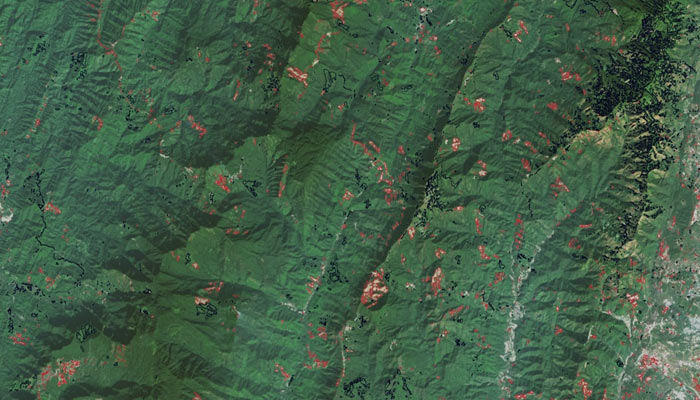
Using high-resolution satellite data and advanced geospatial intelligence, the study mapped critical shifts in land cover in Manipur, it said in the study titled ‘Manipur Deforestation: A Closer Look at Alarming Trends and Emerging Hope’.
“The findings are sobering: an estimated 21,100 hectares [52,000 acres] of forest were lost during this four-year span… due to a combination of anthropogenic and environmental factors,” the study said.
The findings also point to a hopeful sign of recovery with an estimated 32 acres of land seeing vegetation regrowth, suggesting that with the right strategies, parts of Manipur’s forests may still recover, it said.
Apart from looking at changes in Manipur’s forest areas, the Suhora study cited some reasons behind the loss of forest areas in the state bordering Myanmar. They include the proliferation of poppy cultivation, especially in remote hill regions, which has led to widespread forest clearing.
April 2024 that illegal opium poppy cultivation area in Manipur fell 60 per cent in the three-year crop cycle period between 2021 and 2024, according to a satellite imagery-based report by the Manipur Remote Sensing Applications Centre (MARSAC).
No scientific study has been done, either by a government or a private agency, on the link between deforestation and illegal opium poppy cultivation, a senior officer in the state forest department adding all that exists on this matter is anecdotal.
The Suhora study appears to agree with this assessment, as it said the drivers behind Manipur’s forest loss are multifaceted and deeply rooted in both traditional and modern practices.
Comments are closed.