
Nepal-Tibet Disaster: Toll Rises To 691, Search For Nearly 3,000 Missing Enters Day 5

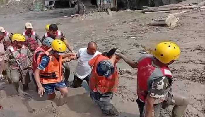
Rescue operations entered their fifth day on Sunday as teams raced to locate survivors and missing people after catastrophic flash floods and debris flows devastated communities along the Nepal-China border.
The combined death toll in Nepal and China’s Tibet region has reached 691, while more than 3,000 people are still missing. Nepal has reported 675 deaths and 2,498 missing people, while Chinese authorities have confirmed 16 deaths and 546 missing in Tibet’s Gyirong county.
More than 3,700 people have been rescued in Nepal so far.
The disaster struck on August 26 after a massive debris flow and flash flood swept through the mountainous border region, destroying homes, roads, bridges and hydropower infrastructure. Rescue efforts have been hampered by steep terrain, narrow valleys, damaged roads and unstable ground.
Search Operations Resume
Nepali authorities resumed search and rescue operations after bad weather temporarily disrupted the mission. Helicopters are being used to evacuate survivors and transport relief supplies to communities isolated by the disaster.
Rescuers are concentrating on several critical locations, including the Upper Trishuli-1 Hydropower Project in Rasuwa. Officials fear more than 100 people could be trapped inside a tunnel buried under mud and debris.
Search operations are also continuing near the badly damaged Gyirong border crossing on the Chinese side.
Nepal has requested specialised international assistance for difficult tunnel rescues, survivor-detection equipment, forensic identification and DNA testing. An Indian tunnel-rescue reconnaissance team has reached Nepal, while China has also deployed specialists.
India has supplied food, medicines and blankets and offered technical teams and prefabricated bridges to help restore connectivity in areas where roads and other infrastructure were destroyed.
Glacier Collapse Believed To Have Triggered Floods
The US Geological Survey (USGS) said the disaster was likely triggered by a rapid slope failure involving a glacier in Nepal’s Langtang National Park near the Chinese border.
The resulting torrent of ice, water and debris travelled almost 100 km downstream through the Lende Khola and Trishuli Khola river systems, gathering additional rocks, soil and water and developing into a powerful debris flow.
The USGS estimated that the slope failure released energy equivalent to a magnitude 5.2 earthquake. However, scientists said it is still unclear whether the initial event should be classified as a landslide involving part of a glacier or a glacial collapse.
Satellite images have shown major changes around the Langtang Lirung glacier. Analysis indicates that part of the lower glacier broke away and crashed into the valley, triggering an avalanche of ice and rock that contributed to the catastrophic flooding downstream.
Threat From New Lake Eases
Authorities have also been monitoring a lake that formed upstream along the Nepal-China border after the disaster, amid concerns that another surge could threaten downstream settlements.
The immediate risk had eased by Saturday after Chinese authorities reported that the water level had fallen and the lake was gradually shrinking. Officials, however, warned that flood risks could continue until upstream water bodies drain fully.
Across Nepal, families are still waiting for news of missing relatives. Authorities have warned that some recovered bodies have deteriorated severely, making visual identification difficult. DNA samples are being collected before burial to help identify victims.
As thousands remain unaccounted for, rescuers continue to search through tunnels, debris and isolated areas for survivors while authorities assess the extensive destruction caused to homes, roads, bridges, hydropower projects and other vital infrastructure.
Comments are closed.